Local History and Memories
It has been my intension for the longest time to begin making some notes of events that I remember while growing up…mostly personal memories, and including a few photos, if possible. I began my quest after lunch (pictured below) on Easter Sunday, 2019, taking a drive out into the county, and thinking about a few events I wanted to write about with a few photos.
However, as of January 2023, I wanted to expand this post, going beyond just personal memories, including “newfound” local history, hence the title “Local History and Memories.”
I’ll be documenting more “historical events” as I remember them, and included in the following:

Date: April 2, 2020: An Army munitions truck explodes on a local bridge during World War II.
An Army munitions truck exploded on this bridge during World War II. I learned the story from my Dad when I was a kid.
On many Sunday afternoons, my Dad and Mom would take me and my older brother to Lake Lure/Chimney Rock, and we’d drive by this bridge. I still remember the conversations concerning the bridge while in the car, even to this day.
I remember hearing my mother say she could hear the explosion from a distance “as the crow flies” of about 20 miles from our home.
The following are some photos from this afternoon. (Friday, April 3, 2020) Despite being really close to a busy highway, I’d say few people are aware of the bridge and what happened there more than 80 years ago.
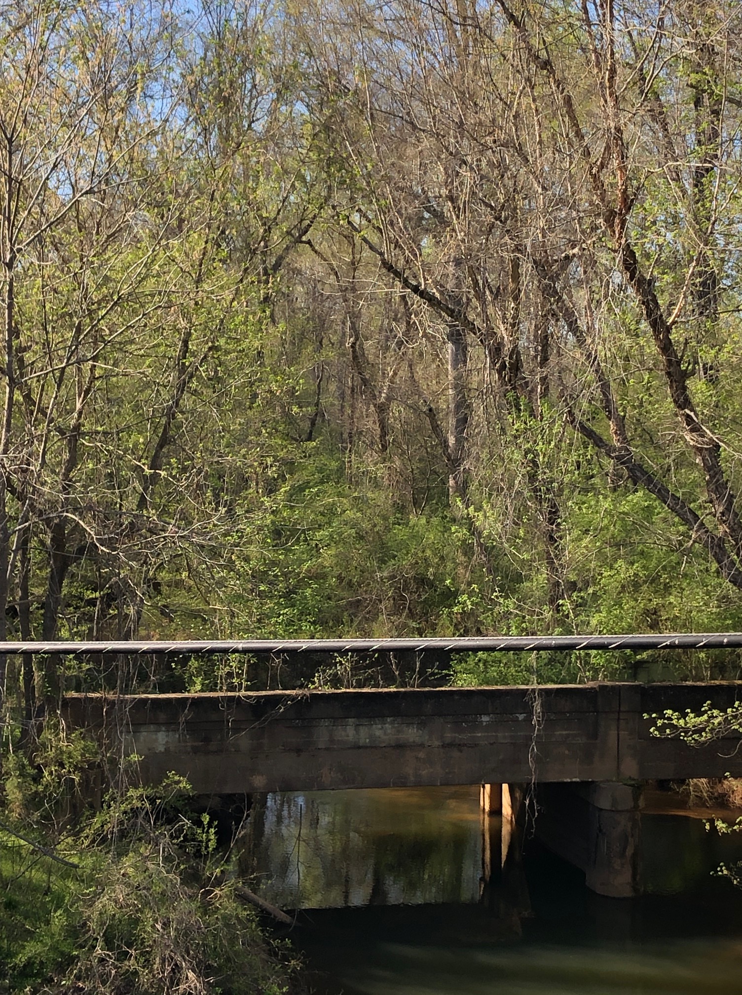
Below: It’s easy to see the damaged concrete side barriers, mostly toward one end and on both sides of the bridge, causing damage well over half the length of the bridge.
So, from this, we can conclude that the truck exploded, either while entering or leaving the bridge.
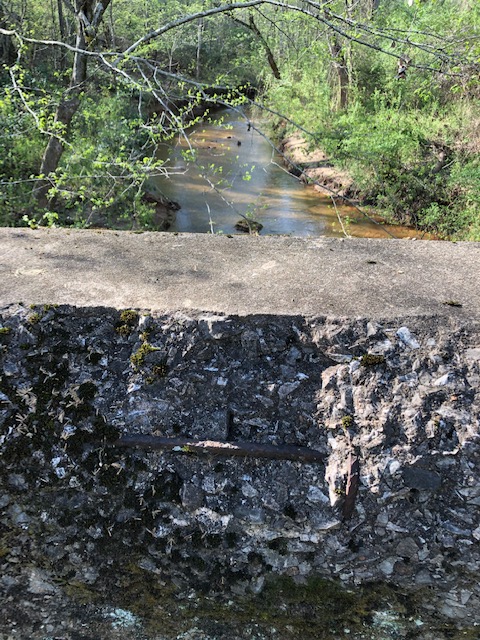
A bullet penetrated the concrete.

The driver was killed, but was there a passenger or others in the truck? I don’t know. This bridge is now just a distant memory of what happened at this site more than eighty years ago.
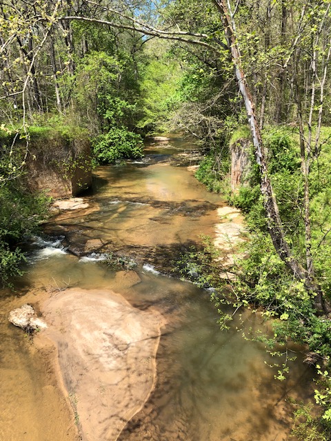
Pictured below: Crooked Run Creek
Note the concrete pillars on each side, toward the top of the following photo. This was where the original bridge crossed the creek on what has always been known as Tan Yard Road. The official name is now, Kistler’s Road.
Note: Tan Yard Road was so named as there was a tannery, very close to the bridge, during the 1800’s.
When I was a kid, this small creek seemed like a raging river. My cousin Myron Edwards told me there was a tavern/hotel and stagecoach stop near this location. And a man was shot and killed at the tavern during the 1800’s, with an “alleged” ghost story of the mans mule, reportedly seen walking in the area for many years following.
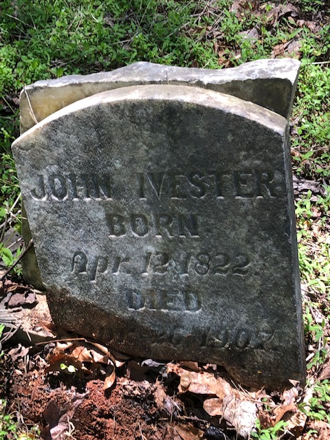
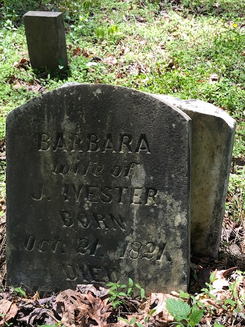
The Tan Yard Cemetery:
(Photo below) The Tan Yard Cemetery (only a hundred or so yards from the bridge) and has many old graves, some of them being my ancestors.
Click on the following link to see those buried in the cemetery.
https://www.findagrave.com/cemetery/2289650/memorial-search
Compiled by the Historical Records Survey of North Carolina, 1939:
“Location: 1/2 mile west of Kistler’s Union Church, 5 miles north of Lawndale, on lands of Velus Ivester. This cemetery was formerly used by a church as a burying ground.”

During the fall of the year, normally near Halloween, the MYF of our church would have a hayride. One regular stop would always include the Tan Yard Cemetery, for a spooky walk around the grave stones. At night it was indeed a spooky place, and I never wanted to be there by myself!
And at that time, we didn’t know about the story of the Tan Yard Ghost. If we had, there’s no telling what we might have seen!
The steam engine explosion, as told by Myron Edwards:
Only a couple or so miles from the Tan Yard Bridge, during the summer of 1900, five men were killed during wheat harvest when a steam engine exploded, just off what is Clover Hill Church Road.
Interesting to note…other events of significance during 1900:
That same summer was the Great Galveston hurricane, and also the “famous” 1900 solar eclipse, on May 28th. Wadesboro, North Carolina was one of the most popular locations for astronomers from around the world which came to view this solar eclipse.
The devastating F4 tornado on May 5th 1989:
Upper Cleveland County and two other adjoining counties encountered, late in the afternoon an F4 tornado on Friday evening, at about 6:00 PM. It first touched down on Mauney Road, where a house was destroyed and a woman being killed. Mauney Road was closed for a period, due to fallen trees and other debris.
Note: An F4 tornado has wind speeds between 200 and 260 miles per hour, which is devastating to anything in its path.
About a mile or so from where the tornado first touched down, it would set down again and would go for 30 or more miles, causing many more injuries and deaths, and thousands and thousands dollars of property damage.
Lawndale-Casar Highway:
A log house and also a brick house were completely destroyed and a huge and very heavy bucket truck was turned onto its side, beside the log house.
The tornado came very close to Kistler’s Methodist Church (1/4-mile north of the the destroyed two houses) and for most-part, damaged only the steeple. However, a church a couple or so miles away was completely destroyed.
I remember vividly, about 3/4 miles north of Kistler’s Church, behind F.V. Ivester’s store…a pick-up truck was lifted up, and sitting on top of a pile of uprooted trees. A memorable sight for sure, one which I’ll never forget, but just one of many.
The tornado remained on the ground, all the way to Toluca, and miles beyond. The tornado destroyed a house just south of the junction (highway 18 and 27) and would cause damage, injuries and deaths in at least two other counties.
A piece of wood, propelled by the tornado, penetrated a mortar joint at Kistler’s Church about 1/2-inch, as my car key illustrates. (see photo below)
However, this was not the first tornado that Cleveland County has encountered, which caused damage.
In 1973, a tornado caused damage just south of Boiling Springs, destroying or causing severe damage to Anthony’s Jewelry Store. Little damage beyond this in Cleveland County, but a textile plant in Cherryville received moderate to mild damage.
During the late 90’s, a tornado’s would cause damage to a Hardee’s Restaurant in Boiling Springs.
And then a few years later, another would cause damage to a “then” manufacturing operation, just off of highway 150, also in Boiling Springs. This is the large building that now faces White’s Automotive.
On the evening of (May 23rd, 2022) Cleveland County and especially Boiling Springs had a tornado warning. Fortunately, we had no damage. But it was the first time that Debbie, myself and Sophie got into our safe place under the stairs. Fortunately, in this area…to my knowledge there wasn’t any damage. However, in relatively close proximity in South Carolina, there was some mild damage to some houses.

November 22nd 1963:` Where were you when John F. Kennedy was assassinated?
For me: I was in the 5th grade at Polkville Elementary School, on the baseball field during recess, near the baseball backstop.
The date and time of the assassination: Friday, November 22nd 1963 @ 1:30 PM EST. The time in Dallas was 12:30 PM CST. When my classmates and I went back inside the news of the event was being broadcast over the school intercom system, via a wooden speaker in the ceiling corner. We were all looking at a dark brown wooden speaker, as if we were seeing live audio.
Since this event occurred on a Friday, my family watched a black and white television almost continually during the weekend. The funeral was on Monday, November 25th. A horse-drawn carriage would then carry the casket (called a caisson) to Arlington Memorial Cemetery….the final resting place of President Kennedy.
Where is Polkville School today?
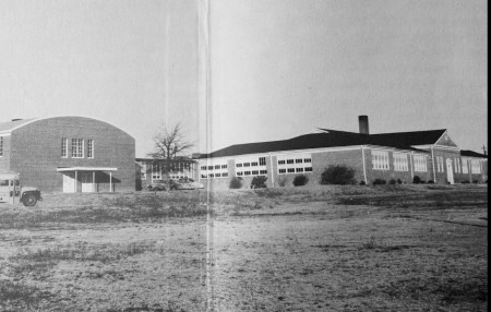
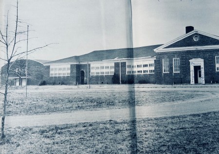
Polkville School was torn down quite a few years ago (maybe about ~2010) with nothing left except the circle drive in front. The school buses were parked around this drive during the day.
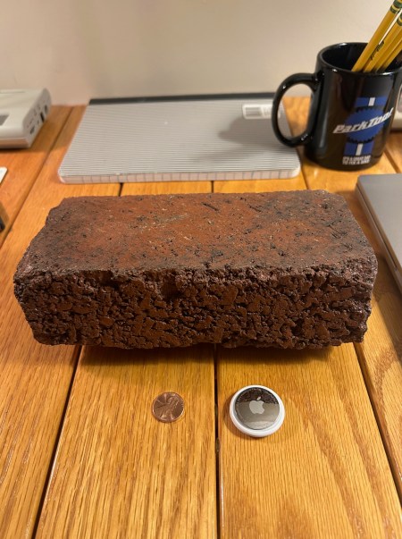
I saved a brick from the school…
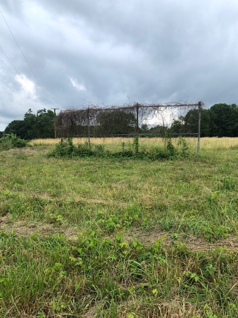
The following photographs of the Polkville baseball field backstop which was removed years ago.
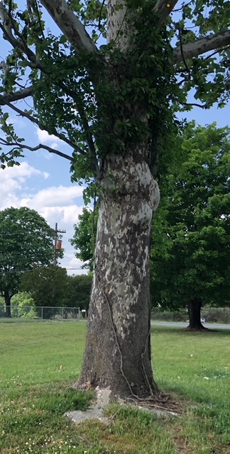
There was and still is a large sycamore tree, directly in front of where my 5th grade class. This tree was used for many years to dust the blackboard erasers by students in the afternoons. I was one of the many students that would receive the eraser assignment in the grades of the 4th and fifth.
November 1965: Going to the drive-in and coming home to witness a plane crash….
November 1965, and my oldest brother Richard took me, my brother Phillip, and Charles Hicks to the drive-in to see a Nascar movie, titled “Red Line 7000.” I was 12 years old at the time, Phillip was 16, and Charlie was 17.
It became really foggy on our trip back home. When we turned off highway 226 and then up the hill heading toward Lawndale on Shelby Road, we saw spotlights and emergency vehicles on the left, just beyond the crest of the hill.
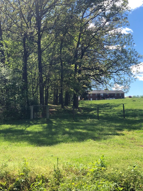
A yellow Piper Cub had crashed within ~100 yards of the highway. We stopped and actually walked to the crash-site. The pilot was killed. I’ll never forget what I saw that night with almost perfect recollection and clarity to this day.
The pilot had to be flying (VFR) or visual flight rules, meaning the pilot operates an aircraft in weather conditions generally clear enough to allow the pilot to see where the airplane is going, definitely not at night.
If you look at the crash site photo (as following) the plane crashed just beside the tree line at the edge of the field, and just to the right of the largest tree and behind the two outermost fence posts.
Charlie Hicks would later have a distinguished career in the Air Force; flying A-10’s, Stealth’s and other high-performance fighter planes. He would also successfully make 200 nighttime carrier landings with the Navy. I feel absolutely certain he had no idea while at the crash scene, he would one day become a true “Top-Gun” pilot.
Note: This was not my first personally “witnessing” of an airplane crash, after the fact. However, I have this in another post. The pilot was also killed in this crash. You might be surprised about this crash. I was in the first grade and was with my daddy eating a sandwich at the All-Day BBQ, which had a gravel circle drive on Grover Street inside the city limits of Shelby, before moving years later to 74 bypass.
Witnessing another plane crash, but years earlier.
I was about six or seven years old? My daddy took me for a BBQ sandwich in Shelby. The location was near the curve going north on Grover Street, just beyond the Shelby Hospital. The “All-Day BBQ” restaurant had a circle “gravel drive” with curb service. It was a favorite hangout for teenagers at that time. A few years later the restaurant would move to the 74 bypass.
When we pulled into the restaurant drive…just on the other side of the road, there was a Yellow Piper Cub, standing right on its nose in a completely vertical position. The pilot was killed. It was said or “alleged” that he ran out of fuel after departing Bridges Airport. This was before the current Shelby Airport was built.
A photo of the crash site or location follows:
When looking across the road from the building formerly Bernhardt Furniture, the plane was vertical in the yard, between the two houses. The year was either 1959 or 1960, and I would have been in either the first or second grade.
Supplemental August 25th 2024: I was talking with Joe Champion this afternoon who said that his dad took both him and his brother to see this plane crash also. Quite a few years back, Joe and I rode many bicycle miles together. And during those rides, neither of us would know that we both witnessed this plane sanding on it’s nose, so many years ago.

A man fell out of an airplane!
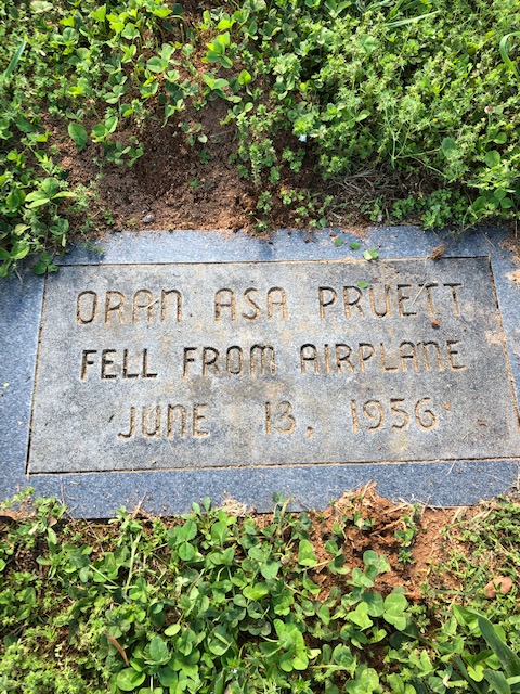
In 1956, a man fell out of a DC-3 and landed in the cemetery of Zion Baptist Church. This is something I’d heard about for so many years while attending elementary school.
June 13, 1956: The date of this event can be seen on the marker pictured below, and is the exact spot of impact. The man’s name was Oran Pruett.
I don’t know “definitively” the facts…but the short story: Pruett “allegedly” just opened the door and fell out. However, I did read a source a few years ago that said Mr. Pruitt had been drinking alcohol. Now I don’t know, but this for sure sounds plausible to me. I’m sure those reading….would agree.
Debbie and I searched the cemetery on a summer afternoon in 2018, looking for the marker, but without success. However, when we were leaving, as luck would have it, we saw and met a church member riding in a golf cart. We asked the man if he knew of the story, he had and told the us the following:
The church custodian on that fateful day heard the sound of Mr. Pruitt descending from the sky, and also the impact.
I remember as a kid, being sick in the late 50’s and very early 60’s, visiting Dr. Edwards, who was my great-uncle (my grandmother’s brother.)
His office or practice was in Toluca, only a few miles from the crossroads of Belwood, just off highway 18.
He was a general practitioner, but delivered over 6,000 babies!
The rock building is still there, but as the photos indicate, it’s in really bad condition with the roof collapsing in many places. The “once” waiting room now has an open sky.
Note the “black” front door in the second photo, which appears to be the original door from at least the 50’s, or the last time I was there. I couldn’t have been more than 10 years old.
I remember the alcohol and sanitary smell, and dreading that “most of the time” a penicillin shot in my hip. That shot would really hurt!


The Delight Alligator: What! An alligator in upper Cleveland County!
The “Delight Alligator” (Delight is a small community, mostly just a crossroads) located between Polkville and Casar.
Yes, there was an alligator, about six to eight feet in length, living in Paul Whisnant’s Pond, in the early to mid-60’s. How did an alligator find its way to that farm pond? No one that I’ve talked with over the years seems to know or remember.
A pond, located on a dirt road that my school bus traveled by so many times, going to Polkville elementary school and back home in the afternoons.
Whatever happened to the alligator, that seemed to have lived in perfect harmony in this farm pond for quite a few years? It was “alleged” or said the alligator decided to leave the pond and venture into the First Broad River, and was later found and killed for obvious reasons.
The story of the “Delight Alligator” seems to be remembered by only a “very few” these days, which is my reason for documenting or writing this story.
Lawndale Snack Shop, operating from the mid-1950’s through ~1965.
While Debbie, myself, and Sophie were in Lawndale today (Thursday, March 24th 2022) I just had to stop and take a few photographs of the former Lawndale Snack Shop and share a few things I remember from those early days.
This was a regular gathering place for “mostly” teenagers. The parking area in front was pretty rough, with washed out ditches and mostly red dirt. No gravel…just dirt. The Snack Shop specialty was hamburgers and french fries. However, since writing this, I’ve been told that “Livermush” sandwiches were also very popular.
Orders would be taken at a small window which is pictured below. The following photo of The Snack Shop as it appears today (March 2022) and no longer a restaurant.

However, curb service was available, for those that chose not to get out of their car. A server would then bring the food out via a tray, that would attach to a partially rolled down window.
I was pretty young during the hay-days of the Snack Shop (about 10-12 years old) but would go there on occasion with my mom and dad. I remember the outside or exterior being painted mostly yellow and the lights underneath the overhang were also yellow.
When coming up the hill from Lawndale at night from a distance, the little “burger joint” appeared as a welcoming beacon of light.
I remember seeing a pink and black 1956 Ford parked out front with finder skirts, which I can see in my mind even to this day. If only I had a photograph of the parking lot during a Sunday afternoon in the late 50’s or early 60’s. It might have been possible to see a 1960 Chevrolet 409, a Ford Fairlane with a 406 engine, a Studebaker, a 1958 Plymouth Fury or maybe even a Henry J.
Guys would often times be standing outside their cars and talking, with the sound of “Sherry” by the Four Seasons playing in the background from a car radio.
If you watched the movie “American Graffiti” you might notice a similarity, to the Snack Shop represented similar events during a period in time, not in California, where the movie was based, but in Lawndale, North Carolina.
This little building in my opinion is a landmark, representing a time when a guys car was their personality or identity.
A time when there were no cell phones that would eventually consume the minds of most all on the planet. A time when music was good. A time when most everyone attended church on Sunday morning. A time when Hollywood and professional athletes had no influence on national or world affairs. A time when everyone seemed much more happy, despite having far fewer material possessions. Yes, it was a simpler time, but my opinion, it was definitely a happier time.
The world takes a turn for the worse:
Unfortunately at this time, the Vietnam war was beginning to escalate, illegal and psychedelic drugs were becoming popular in other parts of the country, and the peace and love movement was coming onto the scene in California, and the rest is history.
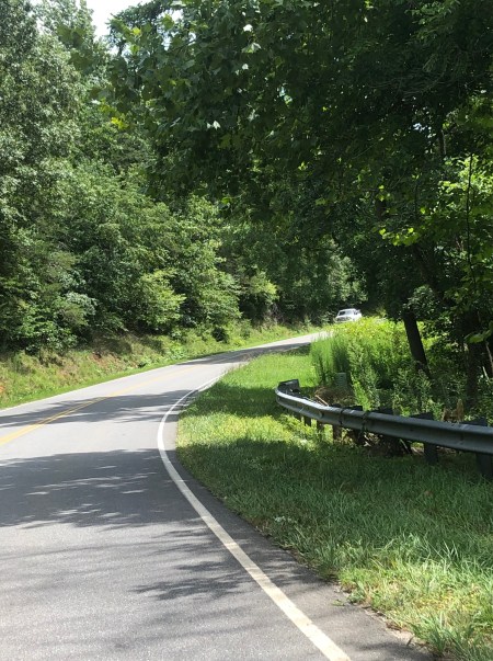
56 years ago (2025) the First Broad River flooded, closing the Lawndale-Casar highway in August 1969, due to Hurricane Camille and one person died.
I’ll never forget looking down from Dale Pendleton’s Barber Shop and seeing the First Broad River crossing the road with a very swift current crossing the Lawndale-Casar highway. The river was only a hundred or so feet from the parking lot of Neason’s Hardware.
In the early morning hours with heavy rain and darkness, a car traveling from the Belwood Road turned left onto the Lawndale-Casar highway, and drove unknowingly into the river. The car and driver were found the next day “seems” it was a few miles down-river.
Point of entry: Where the guardrail is now currently located.
The heavy rains that caused the flooding was most likely due to Hurricane Camille. I can’t confirm or “definitively” say this, but the time period is right. I was 16 years old and just completed a summer job at a furniture company in Lincolnton, which would have been about the second week of August.
Hurricane Camille made landfall on the Mississippi gulf coast in the early morning hours of August 17th, 1969 and packing (a peak wind of 175 mph) causing tremendous damage inland. Camille killed 259 people and with property losses in excess of $12 billion (2024 dollars). Some rural towns in western Virginia, to this day, even after more than 50 years, have still not recovered. Hurricane Camille is the second most powerful Hurricane on record, second only to the 1935 Labor Day Hurricane.
Following photos:
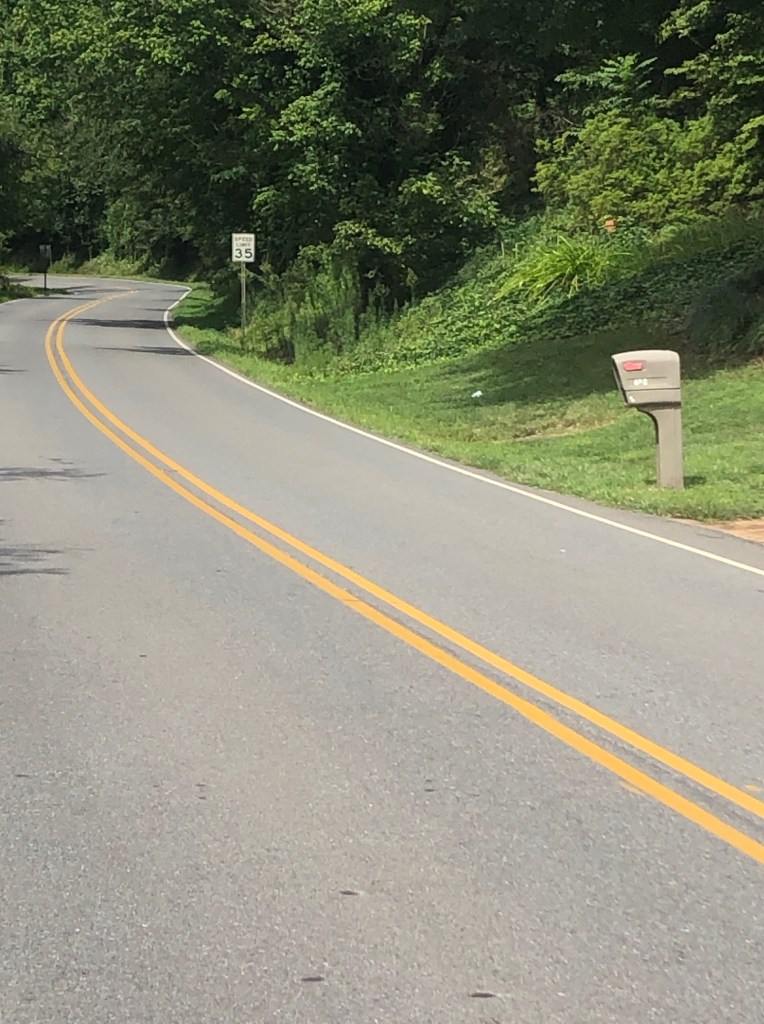
Just to the north of Neason’s hardware, on the Lawndale-Casar highway, the river was a couple feet up on the speed limit sign. The following is a very recent photo.
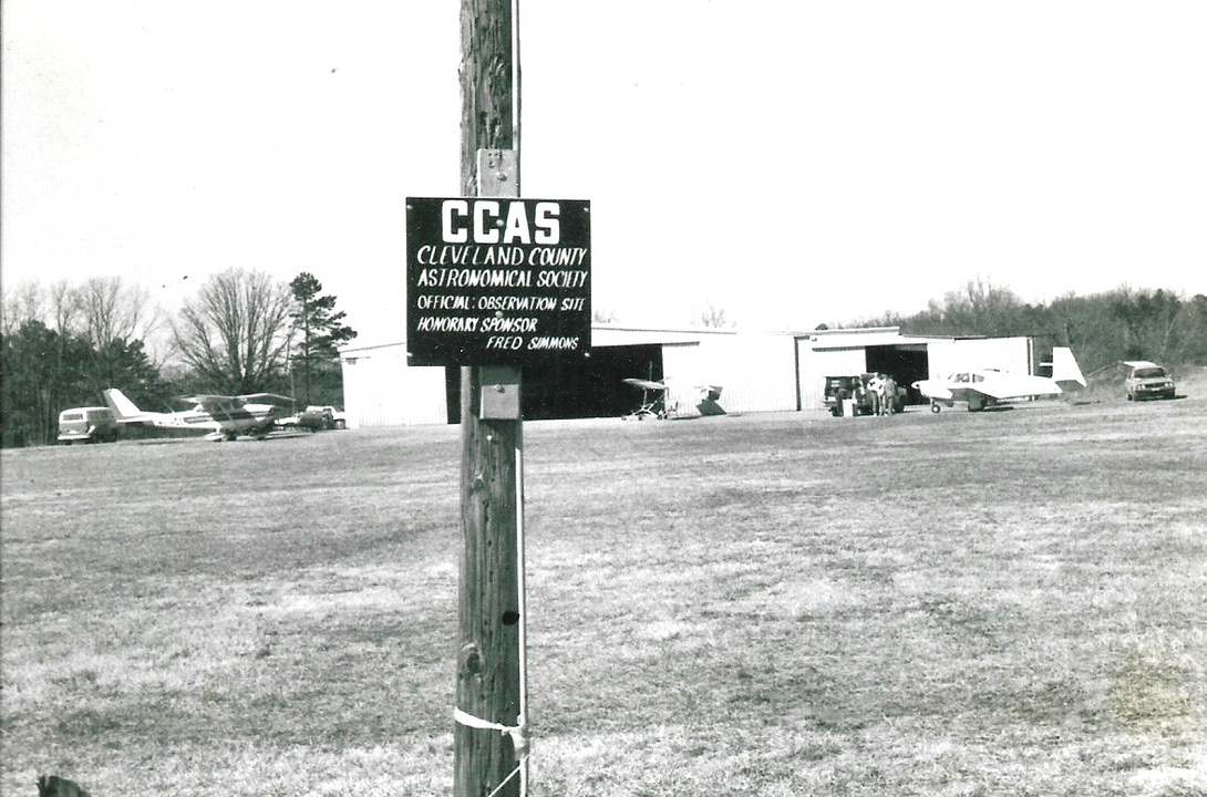
Cleveland County Astronomical Society Observing Site: Polkville Airstrip July 1986 And First Photo Of The New Astronomy Club
I’ve had an interest in amateur astronomy since I was 12 years old in 1965. My older brother, Jim had purchased a 60mm f/15 equatorially mounted refractor. I began using this telescope to observe the moon. I really wanted to see some of those beautiful spiral galaxies, star clusters, and nebulae I’d seen in my 6th grade science book. However, this was just not my time for going beyond the solar system, as I needed to learn my way around the sky.
Fast forward twelve years…
In March 1977 I would purchase my first “very own” telescope, a 4.25-inch EQ mounted reflector. A humble telescope by todays standards, but this would begin my quest to become a serious amateur astronomer, which continues to this day. This telescope was only a beginning, as I would later own at least twelve, at one time or another. However, as of today I have only four telescopes, with each having a specific purpose. It was just time to downsize.
In 1986, the year of Halley’s Comet, I became a founding member of the newly formed “Cleveland County Astronomical Society” meeting at various locations for a few years.
The club for the past 35 years meets once a month at the Williams Observatory on the campus of Gardner-Webb University in Boiling Springs, North Carolina.
It was actually my youngest son, Brad who read an advertisement in the local newspaper. The ad was asking for anyone interested in being a part of establishing an astronomy club in Cleveland County. We were in!!!
Photo below: That same year, we would begin meeting for deep-sky telescope observations at the Polkville airport which was our designated dark-site for a few years.
The first photo of the “newly formed” astronomy club.
That’s me…behind the telescope, and Brad is the youngest person in the photo.
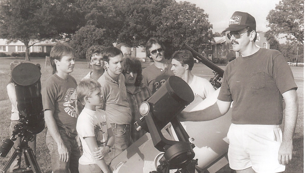
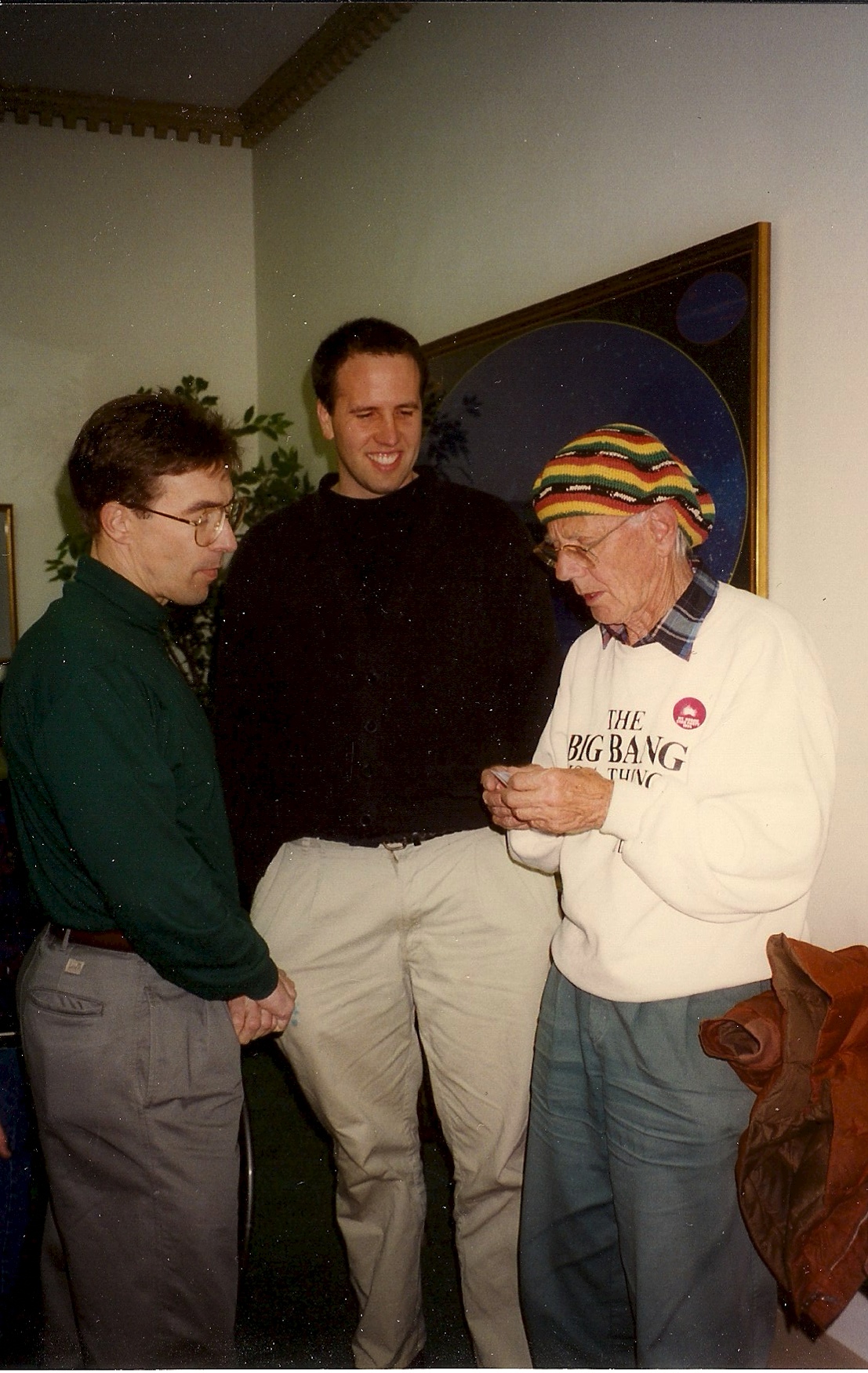
Photo as following: 1994″Regional Gathering of Amateur Astronomers” Cleveland County Astronomical Society current and former officers.
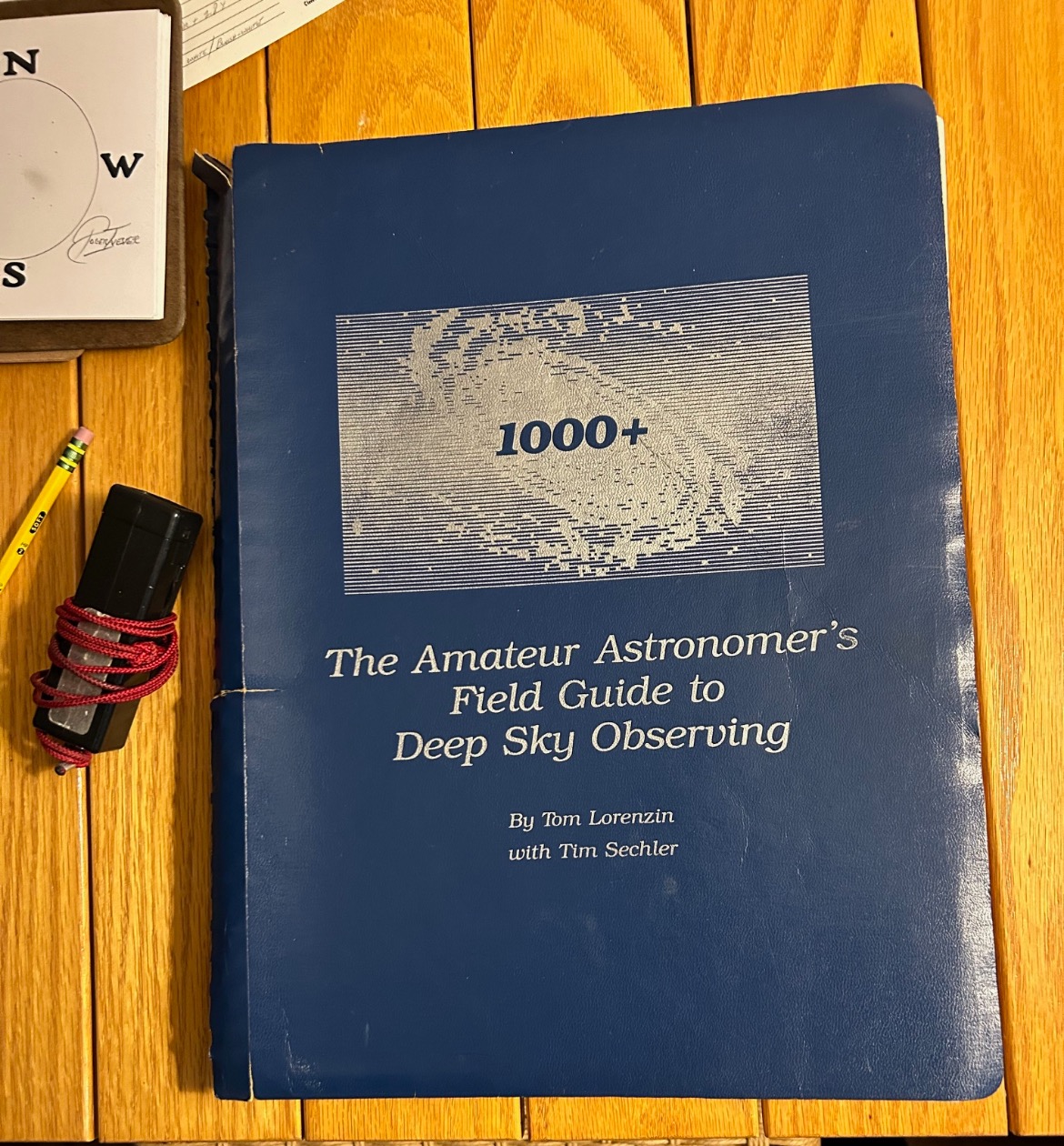
Also Tom Lorenzin (to my left) Astronomy writer and author of “1000+ The Amateur Astronomer’s Field Guide…”
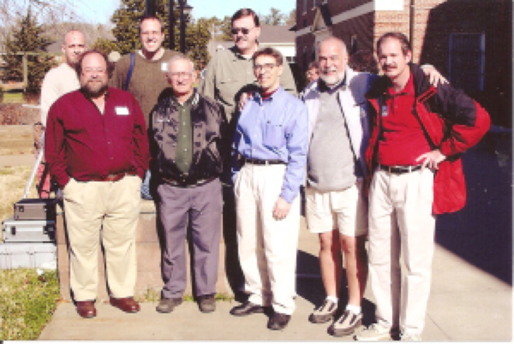
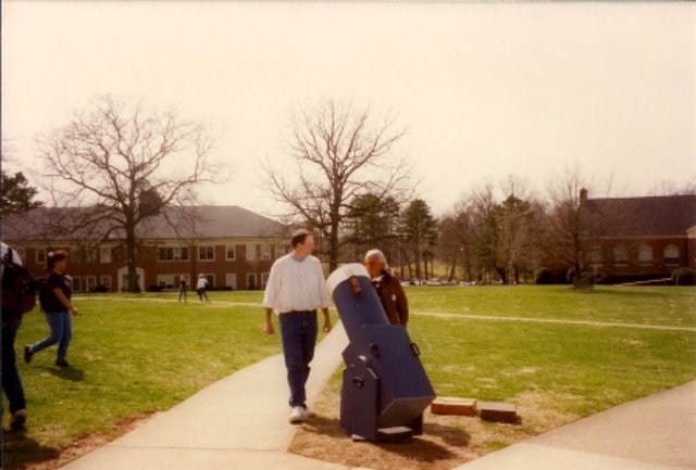
The CCAS would host the very popular “Regional Gathering of Amateur Astronomers” for more than two decades:
Below: John Dobson the inventor of the Dobsonian telescope would visit the CCAS during the 90’s.